-
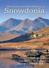 Mountain and Hill Walking in Snowdonia is a two volume in-depth guide to every summit of note in the Snowdonia National Park. Each recommended route is described in detail and accompanied by a full colour relief map. All the routes are circular and include information on parking, distance and height gained. Volume 1 covers the northern half of the National Park.
 -
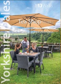 A visit to a tea shop or cafe makes for a lovely end to a walk. It’s always a treat to sit down to coffee and cake at the end of an afternoon stroll or to tuck into a hearty lunch half-way through a day-long hike. From village halls and quaint tea rooms that still serve tea from teapots to modern cafés staffed by efficient baristas, the Yorkshire Dales have plenty to offer — and all surrounded by a timeless and unspoilt landscape. The ten tea shops in this book have been chosen partly on the basis of the excellent walking that can be enjoyed from their doors, and partly on the basis of their wonderful food and drinks and welcoming ambience.
 -
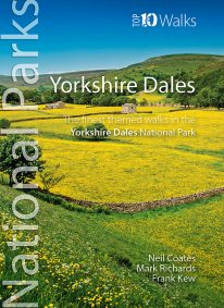 Discover the very best walks in the Yorkshire Dales National Park. These ten themed walks explore the contrasting faces of the Yorkshire Dales — the gentle flower-filled Dales and the wild and rugged uplands with their drystone walls, waterfalls, limestone pavements and iconic peaks. Find unspoiled pubs and friendly teashops. Visit tiny villages, castles, churches and ancient abbeys. Stroll beside crystal rivers or thrill to the thunder of some of Britain’s mightiest waterfalls. Conquer the Three Peaks of Pen-y-ghent, Ingleborough and Whernside. Or just enjoy the quiet countryside and spectacular scenery. Every walk here is a walk to savour.
 -
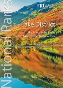 Discover the very best of the Lake District. Part of the Lake District’s unique attraction is its compactness. Within its boundaries are a rich mix of lakes, mountains, forests and farmland characterised by pretty villages, winding roads, deep dales and valleys, drystone walls and distinctive Herdwick and Swaledale sheep. Ready to explore? Discover the two loveliest lakeside walks, the best pub walk, and the most amazing view. Visit Cumbria’s stunning Castlerigg stone circle, scale its best-loved low and high fells, or marvel at its most dramatic waterfall. Every one is a walk to remember.
 -
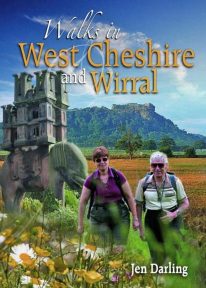 A Cheshire walking classic. With this book you’ll discover parts of Cheshire and Wirral you never knew existed. Ranging from 3-7 miles/5-11 kilometres in length, each of the walks features a reader-friendly factfile, clear route map and matching numbered walks directions, plentiful black and white and colour photographs, as well as fascinating snippets on local history, folklore, architecture and wildlife. Rewalked and revised 2021
 -
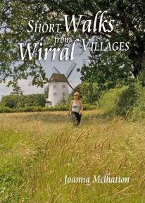 The 30 short circular walks in this book have been written with the non-serious walker in mind, varying in length from just 1 to 4¾ miles (1.5km to 7.5km). Each walk has something of interest to discover — you will visit the site of an ancient port now completely dried out and over a mile inland; a seafront with neither sand nor sea; a wild, wooded river valley in the heart of industrial Merseyside and a lowland heath with wide views to the Welsh hills
 -

Helvellyn - Neck Gaiter/Scarf/Snood
Wearable large-scale 1:25,000 Ordnance Survey map artwork: Helvellyn in the Lake District
HELVELLYN IS ONE OF THE LAKE DISTRICT'S MOST POPULAR PEAKS at 950 metres / 3,118 feet above sea level. The luxurious, silky neck tube features wearable large-scale 1:25,000 Ordnance Survey map artwork. Now you or a friend can own this stylish and permanent souvenir of an iconic mountain. Note: While the Ordnance Survey mapping used on the snood is up-to-date at the time of production, it is not recommended for navigation. Walkers should carry the correct OS online or sheet map and compass.Ordnance Survey Licence No.: 0100047867
-
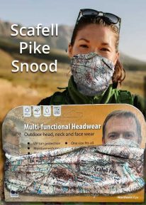
Scafell Pike - Neck Tube/Scarf/Snood
Wearable large-scale 1:25,000 Ordnance Survey map artwork: Scafell Pike in the Lake District
CELEBRATE ENGLAND'S HIGHEST MOUNTAIN and one of the National Three Peaks Challenge summits with this attractive modern Ordnance Survey 1:25,000 scale mapping snood or neck warmer. It looks great and will keep you snug and comfortable on the way up and down. The perfect gift or souvenir for everyone who climbs - or is about to climb - this iconic peak. Note: While the Ordnance Survey mapping used on the snood is up-to-date at the time of production, it is not recommended for navigation. Walkers should carry the correct OS online or sheet map and compass.Ordnance Survey Licence No.: 0100047867
-
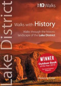 WINNER OF TGO’s ‘BEST GUIDEBOOK’ AWARD 2013 This award-winning book of short circular walks explores the ten most amazing historic sites in the Lake District. It may not seem obvious at first, but the rich human heritage of the area we now call the Lake District is evident all around us as we walk the fells and dales. From the enigmatic monuments built by prehistoric peoples to the industrial scars left in more modern times, centuries of human habitation have left their mark on this landscape. Keep your eyes and your imagination open, and you will come to realise that every step you take is a step through time. A worthy winner.
 -
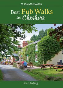 by Jen Darling CHESHIRE IS WELL KNOWN for both its beautiful countryside and its country pubs. This fully revised and updated, 3rd edition of a classic guide book combines the two with superb walks through varied countryside, each one visiting a walker-friendly pub that is well known for its food and drink. The 220-page book ideal for those with a connoisseur’s interest in Real Ale, and for walkers wanting a convenient starting point and route directions - plus some of the best pub lunches in Cheshire. There are 30 circular walks included, covering the entire county from west to east and north to south. Each walk is graded in terms of mileage and difficulty — so families with young children can choose the easy ones, and enthusiasts can find more challenging routes to work up a thirst!
 -
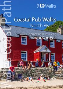
North Wales' best coastal pub walks
The comfortable, friendly and often upmarket pubs along the North Wales coast complement the walking on this superb stretch of the Wales Coast Path. Each walk incorporates a section of the Wales Coast Path, and starts and finishes close to a great, carefully selected pub. Combined, they cover the very best stretches of North Wales' coastline, one of striking contrasts and wonderful surprises. The easy, circular pub walks take in the North Wales Coast between Chester and Caernarfon, the Isle of Anglesey, and the remote Llyn peninsula. All the pubs are situated either right on the coast or a short hop inland — some in coves and harbours, some in the dunes or close to clifftops, others almost on the sand — and the majority are open all day. With the pubs often open all year and the walking good in all seasons, the North Wales Coast, Anglesey and the Llyn are quite rightly a year-round destination.