-
 by Vivienne Crow This exciting, new and interactive guide brings families with children ten of the very best family adventures in the Lake District National Park. With expertly-chosen adventures, superb photographs, clear information, an overview and introduction for each walk, expertly written numbered directions, large scale maps, and four themed interactive challenges for every adventure, these guides set a new standard in design, concept, clarity and ease-of-use.
 -
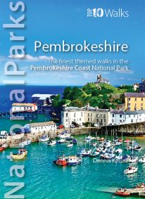 by Dennis Kelsall This superbly-written and good looking book will take you on ten short circular walks to the very best stretches of coast, pubs, tea shops, and viewpoints that the beautiful Pembrokeshire coast, in West Wales, has to offer. Defining the south-westernmost tip of Wales, Pembrokeshire’s coastline is arguably the most beautiful and varied in the British Isles. Virtually all of it lies within the Pembrokeshire Coast National Park. Relative isolation has left it largely untouched by modern development and most of its length is a wild frontier where the endless confrontation between sea and land is played out. Long stretches of coast face the fury of Atlantic storms and weakness and faults in the high cliffs are eroded into caves, coves and inlets. However, the harder rock, some of which is 700 million years old, resists the onslaught and stands out in rugged promontories and headlands. Elsewhere, sheltered landings and harbours, fine beaches and secluded bays reveal other aspects of this glorious landscape. In spring and summer the cliff tops break out in the pink, blue, white and yellow of countless flowers and sea crags are alive with nesting birds, while some of Britain’s largest seal populations arrive in autumn to give birth. It was this wild beauty that prompted the establishment of the Pembrokeshire Coast National Park in 1952. Despite being one of the UK’s smaller National Parks, it embraces a third of the county including all the offshore islands, the Daugleddau estuary, and the Preseli Hills. The Park is also home to the popular Pembrokeshire Coast Path — now part of the larger Wales Coast Path. Discover dramatic coastlines at St Davids Head and Strumble Head, Manorbier and Tenby. Climb to lofty coastal panoramas at Carn Ingli and Carn Llidi. Enjoy characterful waterside pubs at Porthgain and Cresswell Quay. Or relax over a quiet cup of coffee or tea and cake at two of Pembrokeshire’s cosiest and most welcoming tea shops and cafés. Unmissable.
 -
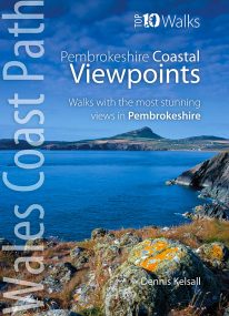 by Dennis Kelsall This attractive and good looking book will take you on ten short circular walks to some of the finest and most iconic views and viewpoints along the rugged Pembrokeshire coast, in West Wales. For some hillwalkers, the ‘view’ is only achieved on attaining the summit. But here, the endless convolutions of the coastline create an ever changing scene, both in front and behind; with every step shifting the perspective, bringing something different into sight. While the distant view can stretch for miles, inlets, coves and bays may remain hidden, only revealing themselves at the last moment. More immediately, the cliffs are broken by crevices, ledges, caves and natural arches, while just offshore are stacks and wave-washed shoals. Behind, the hinterland is a patchwork of hill, common and agriculture, while the vista out to the sea is endlessly changed by the weather, tide and hour. And, where accessible, the prospect from the beach is different again. Memorable walks to unmissable views.
 -
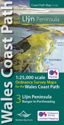 Enhanced, large scale (1: 25,000) Ordnance Survey mapping in a handy atlas format with all the mapping you need to walk a complete circuit of the Anglesey section of the Wales Coast Path. Continuous OS mapping covering the complete route from Bangor to Porthmadog. Contains coastal extracts from large scale Explorer maps 253 and 254. The Llyn Peninsula Ordnance Survey mapping book is part of a series of map atlases covering the whole of the 870-mile long Wales Coast Path. The enhanced OS 1:25,000 maps are accurate, up-to-date and reliable. Additional map symbols show tea shops, cafes, extra parking, and public toilets. A brief introduction to the Llyn Peninsula includes a fascinating photo mosaic highlighting notable views, places of interest and wildlife you'll meet along the way. There is also a section of detailed Useful Information at the back of the atlas. Laminated flapped covers showing Wales Coast Path signs and waymarkers, route details and map symbols make these atlases simple and easy to use. The map books’ dimensions are 215mm x 107mm and they fit easily into a standard map pocket.
- Large scale Ordnance Survey Explorer mapping for the complete coast of the Llyn Peninsula in a handy atlas format.
- Highlighted official route of the Wales Coast Path.
- On-map symbols showing amenities at main towns and villages.
- Introduction with attractive photo mosaic.
- Additional useful information
-
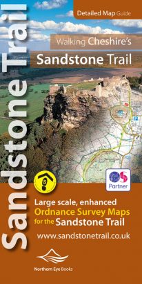
Large-scale Ordnance Survey maps for walking Cheshire's Sandstone Trail in a handy pocket size book.
Cheshire’s Sandstone Trail is probably the most popular middle-distance walk in Northwest England. Here, in handy, pocket size book format are all the maps you need to walk Cheshire's entire 55 kilometre/34 mile Trail.- Enlarged and enhanced, large scale 1:25,000 Ordnance Survey mapping for the whole Sandstone Trail
- Up-to-date route of Sandstone Trail clearly highlighted in yellow
- Extra map symbols for pubs, tea rooms, parking and more
- Trail introduction and photo mosaic
- Useful information section
- Ideal for walkers and all outdoor enthusiasts along Cheshire's sandstone ridge
- Contains relevant mapping from two OS maps for the price of one
-
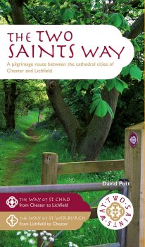 An impressive guide book that coincides with the growing interest in pilgrimage as an aspect of ‘wellness’ tourism that benefits body, mind and spirit. The guide is packed with information both practical and historical. It is an attractive publication with OS map extracts and numerous high quality colour photos. The Two Saints Way has a symmetrical structure with the two cathedrals at either end, Stoke Minster in the middle and two churches dedicated to St Mary at the quarter points. With this in mind, the 92 mile route is divided into four colour coded sections - 1: Chester to Nantwich, 2: Nantwich to Stoke, 3: Stoke to Stafford and 4: Stafford to Lichfield. Each section is further divided into four stages of between 3.5 and 8.5 miles in length. The route is described in both directions. Highlights on this varied route include Beeston Castle, Englelsea Brook Chapel and Museum, the Staffordshire Hoard at the Potteries Museum, Trentham Gardens and Cannock Chase Area of outstanding Natural Beauty. The guide contains a wealth of fascinating information on many features of interest.
 -
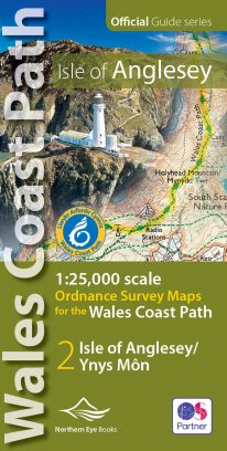 Enhanced, large scale (1: 25,000) Ordnance Survey mapping in a handy atlas format with all the mapping you need to walk a complete circuit of the Anglesey section of the Wales Coast Path. Continuous OS mapping covering the complete circuit from Menai Bridge. Contains coastal extracts from large scale Explorer maps 262 and 263. The Isle of Anglesey/Ynys Mon Ordnance Survey mapping book is part of a series of map atlases covering the whole of the 870-mile long Wales Coast Path. The enhanced OS 1:25,000 maps are accurate, up-to-date and reliable. Additional map symbols show tea shops, cafes, extra parking, and public toilets. A brief introduction to Anglesey includes a fascinating photo mosaic highlighting notable views, places of interest and wildlife you'll meet along the way. There is also a section of detailed Useful Information at the back of the atlas. Laminated flapped covers showing Wales Coast Path signs and waymarkers, route details and map symbols make these atlases simple and easy to use. The map books’ dimensions are 215mm x 107mm and they fit easily into a standard map pocket.
- Large scale Ordnance Survey Explorer mapping for the complete coast of the Isle of Anglesey/Ynys Mon in a handy atlas format.
- Highlighted official route of the Wales Coast Path.
- On-map symbols showing amenities at main towns and villages.
- Introduction with attractive photo mosaic.
- Additional useful information
-
 A visit to a tea shop or cafe makes for a lovely end to a walk. It’s always a treat to sit down to coffee and cake at the end of an afternoon stroll or to tuck into a hearty lunch half-way through a day-long hike. From village halls and quaint tea rooms that still serve tea from teapots to modern cafés staffed by efficient baristas, the Yorkshire Dales have plenty to offer — and all surrounded by a timeless and unspoilt landscape. The ten tea shops in this book have been chosen partly on the basis of the excellent walking that can be enjoyed from their doors, and partly on the basis of their wonderful food and drinks and welcoming ambience.
 -
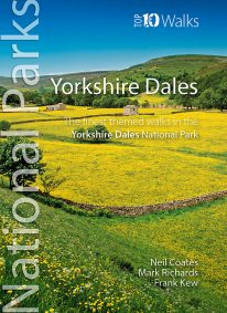 Discover the very best walks in the Yorkshire Dales National Park. These ten themed walks explore the contrasting faces of the Yorkshire Dales — the gentle flower-filled Dales and the wild and rugged uplands with their drystone walls, waterfalls, limestone pavements and iconic peaks. Find unspoiled pubs and friendly teashops. Visit tiny villages, castles, churches and ancient abbeys. Stroll beside crystal rivers or thrill to the thunder of some of Britain’s mightiest waterfalls. Conquer the Three Peaks of Pen-y-ghent, Ingleborough and Whernside. Or just enjoy the quiet countryside and spectacular scenery. Every walk here is a walk to savour.
 -
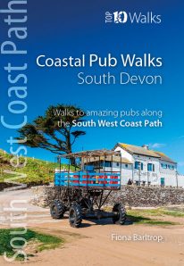
South Devon's best coastal pub walks
The lovely pubs along the South Devon coast complement the walking on this superlative stretch of the South West Coast Path. Each walk incorporates a stretch of the South West Coast Path, and starts and finishes close to a great pub. Combined, they cover the very best stretches of South Devon's coastline, one of great natural beauty and variety. The pub walks are ordered from west to east, starting at Noss Mayo on the Yealm estuary and finishing at Branscombe, near Beer. All the pubs are situated either right on the coast or a short distance inland — some in coves and harbours, others almost on the sand — and the majority are open all day. With the pubs open all year and the walking good in all seasons, the South Devon Coast is quite rightly a year-round destination. -
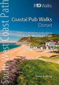
Dorset's best coastal pub walks
The excellent pubs along the Dorset coast complement the walking on this superlative stretch of the South West Coast Path. Each walk incorporates a stretch of the South West Coast Path, and starts and finishes close to a superb pub. Combined they cover the very best stretches of Dorset’s coastline, one of great natural beauty and variety. The pub walks here are also ordered from west to east, starting with Lyme Regis and finishing at Studland. All the pubs are situated either right on the coast or a short distance inland — some in coves and harbours, others right on the beach — and almost every one is open all day. With the pubs open all year and the walking good in all seasons, Dorset’s iconic Jurassic Coast is a year-round destination. -
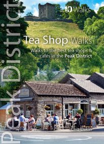 The Peak District abounds with cafes and tea shops offering fabulous, freshly brewed coffee and a mouthwatering variety of speciality teas. This pocket-size guide picks carefully selected cafés across the Peak District — in locations ranging from former stations to community cafés, National Trust properties to hillside farms, and bakeries on town streets to tearooms tucked down alleyways. All of them offer a great choice of often home-baked or locally sourced produce, and a pleasant place to relax after a refreshing walk. This handy pocket size book will take you on short circular walks to the ten friendliest and most fantastic cafes and tea shops in the Peak District.