-
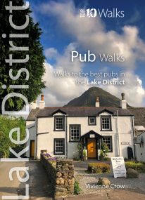 Here in one pocket size book are ten, easy, short circular walks to the finest Lake District pubs. The words ‘Lakeland’ and ‘pub’ go together like ‘bread’ and ‘butter’ or ‘Romeo’ and ‘Juliet’. The Lake District is a region that’s famed for its traditional inns and cosy, friendly village pubs almost as much as it’s famed for its magnificent walking country. So, what could be better than combining the two—enjoying a pint of local ale half-way through a gorgeous Sunday stroll, or a hearty meal at the end of a day’s hiking?
 -
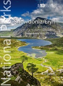
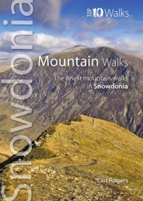 The hills and mountains of Snowdonia will captivate any lover of wild mountain scenery, with around 100 summits above 2,000 feet (approximately 610 metres) and fourteen exceeding 3,000 feet (914 metres). The ten classic walks in this great little guide have been chosen to give a variety of routes, spread across the entire National Park, with most of the main hill groups represented. For each mountain the most scenic route has been chosen and where possible these are well-established, classic paths, easy to follow, with good access and official parking. Enjoy Snowdonia.
 -
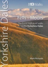 This attractive pocket size book features the ten finest short circular walks on the fells and moors of the Yorkshire Dales. The term ‘fell’ derives from the Norse settlers and was applied here to areas of upland pasture. While the Lake District is defined by its soaring ridges, the Dales, as their name implies, are an intricate pattern of valleys set in a muted moorland landscape. Yet great hills exist — to enthral and enthuse even the most ardent hillgoer. There is no better way of grasping the scale, beauty and extent of the Yorkshire Dales than from this fabulous compact of high fell tops. Each rooted in a dale, each dignified with unique prospects, all meriting walking as a richly rewarding company of hills.
 -
 Product Description One of nine books in the new Top 10 Walks: Wales Coast Path series. This attractive and cleverly structured guidebook gives walkers the ten best walks on the southern part of the South Wales Coast section of the Wales Coast Path, in a popular pocketable format. With clear information, an overview and introduction for each walk, expertly written numbered directions, Ordnance Survey maps, superb, eye-grabbing panoramic photographs, and interpretation of points of interest along the way, these guides set a new standard in clarity, appeal and ease-of-use. Contents The Wales Coast Path: an introduction Top Ten Walks: Wales Coast Path: North Wales Coast: a photo mosaic
- Holywell & Basinwerk Abbey
- Talacre & Gronant dunes
- Prestatyn to Graig Fawr
- Rhyl to Rhuddlan Castle
- Little Orme
- Around the Great Orme
- Conwy Mountain
- Above Penmaenmawr
- Aber Falls
- Lafan Sands - low/high loop
-
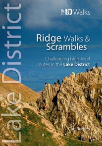 The Lakeland Fells have some of the finest ridge walks in the country. Exploring these ridges offers fell walking at its most satisfying — staying high, taking in several summits and enjoying the spectacular settings. Many of the Lake District’s ridge walks have become classics, like the grassy edges of the Fairfield and Kentmere Horseshoes, or rocky aretes of Striding Edge and Swirral Edge and the aptly named Sharp Edge of Blencathra.
 -
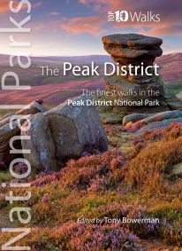 Discover the very best of the Peak District. These ten themed walks explore the contrasting faces of the Peaks — the gentle White and rugged Dark Peak. Discover clear rivers and streams, ancient packhorse bridges and stepping stones. Walk through winding dales and valleys bright with wildflowers. Visit stately Chatsworth or marvel at the panorama from Monsal Head. Tour upland reservoirs and dramatic rocky edges popular with climbers. Slog up Shutlingsloe or explore the open moorland and strangely eroded tors on Kinder Edge. Every one is a walk to remember.
 -
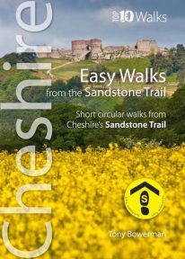 Cheshire’s Sandstone Trail is probably the most popular middle-distance walk in Northwest England. The Trail runs for 55 kilometres/34 miles along Cheshire’s beautiful and varied central sandstone ridge between Frodsham and Whitchurch, just over the border in Shropshire. This cleverly structured and well designed guidebook gives walkers the ten best short circular walks along the length of the Sandstone Trail in a handy, pocketable format.
 -
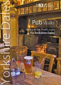 This lovely little book will take you on short circular walks to some of the Yorkshire Dales' most distinctive pubs and inns. The pubs of the Yorkshire Dales reflect both the area and the local people: occasionally gritty and challenging, sometimes uncompromising but essentially hugely welcoming and full of character. Some of England’s best watering holes stand here beside country lanes and village greens as they have for centuries past, gathering and exuding that unique amalgam which defines a pub. The flagged floors, the winter fires, the lamplight pooling onto lanes through bottle-glass windows, the quirky bars; that happy jigsaw of time and place which makes rambling to and between them one of life’s great pleasures.
 -
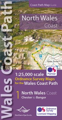 Enhanced, large scale (1: 25,000) Ordnance Survey mapping in a handy atlas format with all the mapping you need to walk a complete North Wales Coast section of the Wales Coast Path. Continuous OS mapping covering the complete route from Chester to Bangor, on the Menai Strait. Contains generous coastal extracts from large-scale OS Explorer maps 266, 265, 264 and OL17. The North Wales Coast Ordnance Survey mapping book is part of a series of map atlases covering the whole of the 870-mile long Wales Coast Path. The enhanced OS 1:25,000 maps are accurate, up-to-date and reliable. Additional map symbols show tea shops, cafes, extra parking, and public toilets. A brief introduction to the North Wales Coast includes a fascinating photo mosaic highlighting notable views, places of interest and wildlife you'll meet along the way. There is also a section of detailed Useful Information at the back of the atlas. Laminated flapped covers showing Wales Coast Path signs and waymarkers, route details and map symbols make these atlases simple and easy to use. The map books’ dimensions are 215mm x 107mm and they fit easily into a standard map pocket.
- Large scale Ordnance Survey Explorer mapping for the complete North Wales Coast in a handy atlas format.
- Highlighted official route of the Wales Coast Path.
- On-map symbols showing amenities at main towns and villages.
- Introduction with attractive photo mosaic.
- Additional useful information
-
Minehead to Bude
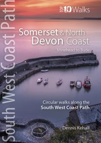
The ten walking routes featured here highlight the best short circular walks along the Somerset and North Devon Coast section of the popular, 630-mile long South West Coast Path (SWCP). Exmoor's fringe of majestic cliffs, secluded coves, ragged wave-washed rocks and rich coastal woodland is a stunning prelude to the long distance trail. Further west are Devon's glorious beaches but also an ever-more rugged coastline, which curves to the battering Atlantic surf. Large settlements are few, but occasional picturesque hamlets and villages grew around coves and small landings where fishing and seaborne trade (not always above board) supplemented the traditional farming way of life of the hinterland. Nature complements the intrinsic beauty of this landscape; seabirds abound on the cliffs and shore, while the lush and sometimes rare flora of unspoiled cliffs, native woodland, rough pasture and dunes supports smaller birds and countless butterflies. The five-book series of 'Top Ten Walks' covers the whole of the UK's famous South West Coast Path. Each book explores the highlights along the way; showcasing its natural beauty, wildlife and heritage. Once you've experienced what the Somerset and North Devon section has to offer, we think you'll be inspired to come back to tackle the complete trail. -
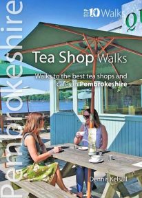 Pembrokeshire’s Café Culture is booming and it’s not the big chains leading the way. Gone are the steamy fugs, greasy-spoon menus and chipped mugs; instead, there’s no shortage of bright and friendly venues serving speciality coffees and teas, home-made baking, and wonderful snacks and meals that capitalise on the best of local produce and culinary talent. Very often there’re take-away options too and sometimes interesting wines or Welsh-brewed beers and ciders. Many are open all day from breakfast and morning coffee to afternoon tea, with some venues running into the evening too with live music, poetry or storytelling. They’re great places to rest or meet up with friends, too; so go for a walk and see what you can find — you’ll not be disappointed.
 -
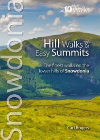 One of a series of four books for Snowdonia in the popular Top 10 Walks series. Handy, pocket-sized, full colour walking guides written by experts. The perfect impulse buy. Free display stands available. Other titles in the series include: Mountain Walks, Ridge Walks & Scrambles and Pub Walks. Uses Ordnance Survey mapping.
 -
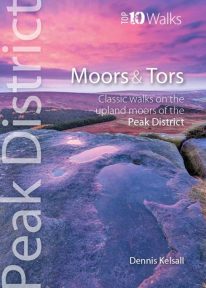 This lovely, pocket size book offers the ten best short circular walks to upland moors and tors across the Peak District. The uplands of the Peak bear the characteristics of hills rather than mountains: high, undulating plateaux dissected by deep, meandering valleys. Yet there is little uniformity; the seemingly remote moorland of the Kinder plateau is in sharp contrast to the gentler and lower upland heaths found farther south. These landscapes change subtly with the seasons and, for those who care to look, are rich in wildlife. There are birds, hares, and foxes; and in summer, adders and lizards bask in the sun while butterflies dance in the remotest places.
 -
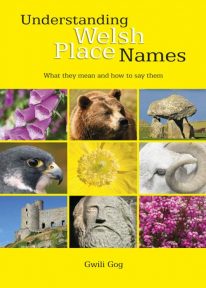 Puzzled by Welsh place names but want to know what they mean and how to say them? This fascinating, easy-to-use guide means non-Welsh speakers can now easily translate and understand place names all over Wales — on the map, on road signs, and out in the countryside. Armed with this insider knowledge, you’ll discover there’s a whole exciting new dimension to the Welsh landscape. In fact, Wales will never be quite the same again ….
 -
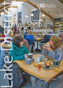 A visit to a tea shop adds something special to a walk. It’s always a treat to sit down to coffee and cake at the end of an afternoon stroll or to tuck into a hearty lunch half-way through a gorgeous hike. From quaint little tea rooms that still serve drinks in china cups to modern cafés staffed by trained baristas, the Lake District has plenty to offer — and all surrounded by a truly breathtaking UNESCO World Heritage landscape. The ten tea shops in this book have been chosen partly on the basis of the excellent walking that can be enjoyed from their doors, and partly on the basis of the fare and ambience they have to offer. They occupy village, lakeside and woodland locations. The walks themselves take in hidden valleys, low fells, lakes, waterfalls, riverside paths, fabulous viewpoints and wildflower-filled woods — a tremendous array of the sort of scenery for which the Lake District has become world famous.
 -
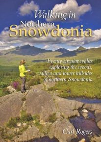 This attractive book explores twenty of the best low level circular walks in northern Snowdonia. Walking in Northern Snowdonia is dedicated to the northern half of the National Park, bounded by the Conwy Valley to the east, Glyn Lledr and the Vale of Ffestiniog to the south and Cwm Pennant to the west. Twenty circular walks are described, ranging in length from 4½ to 9 miles, which explore the woods, valleys and lower hillsides of this unique and beautiful area.
 -
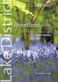 This lovely little book will take you on ten short circular walks through the finest woods and forests in the Lake District People seem to be drawn to trees, be they part of a landscape that has existed for centuries or planted in more modern times. There is something special about being in among their sturdy trunks, surrounded by a rich understorey with the sunlight piercing the canopy high above. In the Lake District, there is a huge variety of woodland — and no matter what their origins, what tree types grow there or how they have been managed, that extraordinary atmosphere never fails to nourish the soul.
 -
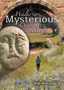
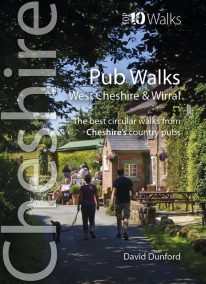 This handy, wonderfully illustrated little guidebook gives walkers the ten best short circular walks to some of the very best country pubs and inns in Cheshire and Wirral in a handy, pocketable format. As befits a well-heeled, fertile county with a rich farming heritage, the country pubs and inns of Cheshire and Wirral are hugely rewarding to visitors and walkers. From numerous candidates we’ve whittled the list down to personal favourites that balance a lack of pretention with good service, and are also blessed with pleasant locations and rewarding walks from the doorstep, while attempting a representative geographical distribution covering the range of landscapes of this diverse county.
 -
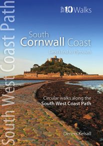
Land's End to Plymouth
The ten walking routes featured here highlight the best short circular walks along the South Cornwall Coast section of the popular, 630-mile long South West Coast Path (SWCP). Running from Land's End at the very western tip of England to Penlee Point, guarding the entrance to Plymouth Sound, Cornwall's deeply convoluted south coast is infinitely varied, ranging from rugged cliffs braced against the full force of Atlantic waves to the sheltered Cornish Riviera where the weather, scenery and flora can be almost Mediterranean. Large towns are few, but attractive villages, hamlets and harbours abound, usually with a welcoming pub or café not far away. The five-book series of 'Top Ten Walks' covers the whole of the UK's famous South West Coast Path. Each book explores the highlights along the way; showcasing its natural beauty, wildlife and heritage. Once you've tasted what the South Cornwall section has to offer, we think you'll be inspired to come back to tackle the complete trail. -
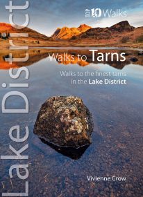 This smashing little book features ten short circular walks to the loveliest tarns in the Lake District. Norsemen, who dominated Lakeland 1,000 years ago, called the small bodies of water they found in the mountains tjorns—‘little lakes’ or , literally, ‘teardrops’. Now known as tarns, they are remnants of the last Ice Age when huge ice sheets scoured out hollows in the mountains that then filled with water. There are hundreds of tarns in the Lake District National Park: from tiny pools sparkling like blue jewels on high, lonely ridge tops, to small lakes sitting cold and moody at the base of sombre cliffs.
 -
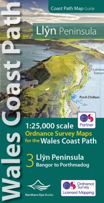 Enhanced, large scale (1: 25,000) Ordnance Survey mapping in a handy atlas format with all the mapping you need to walk a complete circuit of the Anglesey section of the Wales Coast Path. Continuous OS mapping covering the complete route from Bangor to Porthmadog. Contains coastal extracts from large scale Explorer maps 253 and 254. The Llyn Peninsula Ordnance Survey mapping book is part of a series of map atlases covering the whole of the 870-mile long Wales Coast Path. The enhanced OS 1:25,000 maps are accurate, up-to-date and reliable. Additional map symbols show tea shops, cafes, extra parking, and public toilets. A brief introduction to the Llyn Peninsula includes a fascinating photo mosaic highlighting notable views, places of interest and wildlife you'll meet along the way. There is also a section of detailed Useful Information at the back of the atlas. Laminated flapped covers showing Wales Coast Path signs and waymarkers, route details and map symbols make these atlases simple and easy to use. The map books’ dimensions are 215mm x 107mm and they fit easily into a standard map pocket.
- Large scale Ordnance Survey Explorer mapping for the complete coast of the Llyn Peninsula in a handy atlas format.
- Highlighted official route of the Wales Coast Path.
- On-map symbols showing amenities at main towns and villages.
- Introduction with attractive photo mosaic.
- Additional useful information
-
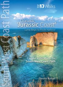
Lyme Regis to Poole Harbour
The ten walks featured here highlight the best short circular walks along Dorset's iconic 'Jurassic Coast' section of the South West Coast Path. The Dorset coast is perhaps the most varied of the whole south western peninsula, encompassing glorious beaches, towering cliffs, detached stacks, long shingle banks and picturesque coves and inlets. The handiwork of man both past and present is there too, in settlement, quarrying and even oil extraction. But there is little to detract from the coast’s overall beauty — and the coast’s huge range of habitats is reflected in the sheer abundance of flowers and wildlife you’ll experience along the way. -

Snowdon - Neck Gaiter/Scarf/Snood
Wearable large-scale 1:25,000 Ordnance Survey map artwork: Snowdon in Snowdonia
SNOWDON IS THE HIGHEST AND MOST POPULAR MOUNTAIN IN WALES. Also known as 'The Top of Wales', it reaches 1,085 metres (3,560 ft) above sea level. This detailed Ordnance Survey mapping snood shows the summit and six main routes of ascent, making it the ideal present or souvenir for everyone who reaches, or dreams of reaching, the top Note: While the Ordnance Survey mapping used on the snood is up-to-date at the time of production, it is not recommended for navigation. Walkers should carry the correct OS online or sheet map and compass.Ordnance Survey Licence No.: 0100047867
-
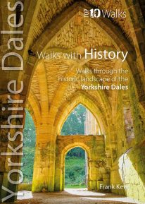 This lovely little book will take you on short circular walks to some of the Yorkshire Dales' most intriguing ancient and historic sites. From mysterious prehistoric rock carvings, Iron Age field systems, Roman roads, and medieval castles, to the very names given to hills, valleys, farms and villages, the Yorkshire Dales are steeped in the histories of countless generations of people who have made the Dales their home. The ten walks featured here visit some of these iconic sites, whether in wild open moorland, or in gentler bucolic farmland. Enjoy superb walking in historic Yorkshire landscapes that resonate with the memory of past lives.
 -
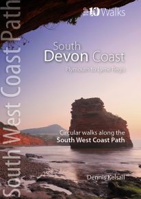
Plymouth to Lyme Regis
The ten walking routes featured here highlight the best short circular walks along the South Devon Coast section of the popular, 630-mile long South West Coast Path (SWCP). Devon has been described as one of England's most beautiful counties, its south coast encompassing everything from superb sandy beaches to soaring cliffs and tiny, secluded coves to sweeping bays. Meandering estuaries and narrow lanes wind to time-forgotten villages and fishing settlements, where flower-decked, thatched cottages and perhaps an inviting country pub cluster around an ancient church. The five book series of 'Top Ten Walks' covers the whole of the SouthWest Coast Path. Each book explores the highlights along the way; showcasing its natural beauty, wildlife and heritage. Once you've tasted what this section has to offer, you may be inspired to come back to tackle the complete trail. -
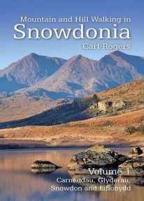 Mountain and Hill Walking in Snowdonia is a two volume in-depth guide to every summit of note in the Snowdonia National Park. Each recommended route is described in detail and accompanied by a full colour relief map. All the routes are circular and include information on parking, distance and height gained. Volume 1 covers the northern half of the National Park.
 -
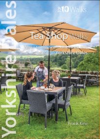 A visit to a tea shop or cafe makes for a lovely end to a walk. It’s always a treat to sit down to coffee and cake at the end of an afternoon stroll or to tuck into a hearty lunch half-way through a day-long hike. From village halls and quaint tea rooms that still serve tea from teapots to modern cafés staffed by efficient baristas, the Yorkshire Dales have plenty to offer — and all surrounded by a timeless and unspoilt landscape. The ten tea shops in this book have been chosen partly on the basis of the excellent walking that can be enjoyed from their doors, and partly on the basis of their wonderful food and drinks and welcoming ambience.
 -
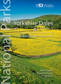 Discover the very best walks in the Yorkshire Dales National Park. These ten themed walks explore the contrasting faces of the Yorkshire Dales — the gentle flower-filled Dales and the wild and rugged uplands with their drystone walls, waterfalls, limestone pavements and iconic peaks. Find unspoiled pubs and friendly teashops. Visit tiny villages, castles, churches and ancient abbeys. Stroll beside crystal rivers or thrill to the thunder of some of Britain’s mightiest waterfalls. Conquer the Three Peaks of Pen-y-ghent, Ingleborough and Whernside. Or just enjoy the quiet countryside and spectacular scenery. Every walk here is a walk to savour.
 -
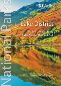 Discover the very best of the Lake District. Part of the Lake District’s unique attraction is its compactness. Within its boundaries are a rich mix of lakes, mountains, forests and farmland characterised by pretty villages, winding roads, deep dales and valleys, drystone walls and distinctive Herdwick and Swaledale sheep. Ready to explore? Discover the two loveliest lakeside walks, the best pub walk, and the most amazing view. Visit Cumbria’s stunning Castlerigg stone circle, scale its best-loved low and high fells, or marvel at its most dramatic waterfall. Every one is a walk to remember.
 -
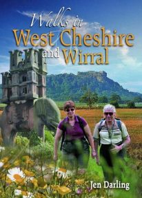 A Cheshire walking classic. With this book you’ll discover parts of Cheshire and Wirral you never knew existed. Ranging from 3-7 miles/5-11 kilometres in length, each of the walks features a reader-friendly factfile, clear route map and matching numbered walks directions, plentiful black and white and colour photographs, as well as fascinating snippets on local history, folklore, architecture and wildlife. Rewalked and revised 2021
 -
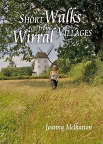 The 30 short circular walks in this book have been written with the non-serious walker in mind, varying in length from just 1 to 4¾ miles (1.5km to 7.5km). Each walk has something of interest to discover — you will visit the site of an ancient port now completely dried out and over a mile inland; a seafront with neither sand nor sea; a wild, wooded river valley in the heart of industrial Merseyside and a lowland heath with wide views to the Welsh hills
 -

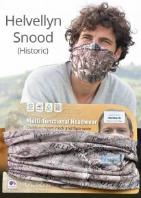
Helvellyn - Neck Gaiter/Scarf/Snood
Wearable large-scale 1:25,000 Ordnance Survey map artwork: Helvellyn in the Lake District
HELVELLYN IS ONE OF THE LAKE DISTRICT'S MOST POPULAR PEAKS at 950 metres / 3,118 feet above sea level. The luxurious, silky neck tube features wearable large-scale 1:25,000 Ordnance Survey map artwork. Now you or a friend can own this stylish and permanent souvenir of an iconic mountain. Note: While the Ordnance Survey mapping used on the snood is up-to-date at the time of production, it is not recommended for navigation. Walkers should carry the correct OS online or sheet map and compass.Ordnance Survey Licence No.: 0100047867
-
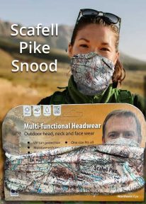
Scafell Pike - Neck Tube/Scarf/Snood
Wearable large-scale 1:25,000 Ordnance Survey map artwork: Scafell Pike in the Lake District
CELEBRATE ENGLAND'S HIGHEST MOUNTAIN and one of the National Three Peaks Challenge summits with this attractive modern Ordnance Survey 1:25,000 scale mapping snood or neck warmer. It looks great and will keep you snug and comfortable on the way up and down. The perfect gift or souvenir for everyone who climbs - or is about to climb - this iconic peak. Note: While the Ordnance Survey mapping used on the snood is up-to-date at the time of production, it is not recommended for navigation. Walkers should carry the correct OS online or sheet map and compass.Ordnance Survey Licence No.: 0100047867
-
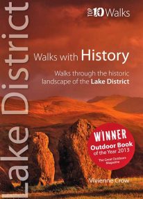 WINNER OF TGO’s ‘BEST GUIDEBOOK’ AWARD 2013 This award-winning book of short circular walks explores the ten most amazing historic sites in the Lake District. It may not seem obvious at first, but the rich human heritage of the area we now call the Lake District is evident all around us as we walk the fells and dales. From the enigmatic monuments built by prehistoric peoples to the industrial scars left in more modern times, centuries of human habitation have left their mark on this landscape. Keep your eyes and your imagination open, and you will come to realise that every step you take is a step through time. A worthy winner.
 -
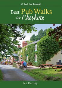 by Jen Darling CHESHIRE IS WELL KNOWN for both its beautiful countryside and its country pubs. This fully revised and updated, 3rd edition of a classic guide book combines the two with superb walks through varied countryside, each one visiting a walker-friendly pub that is well known for its food and drink. The 220-page book ideal for those with a connoisseur’s interest in Real Ale, and for walkers wanting a convenient starting point and route directions - plus some of the best pub lunches in Cheshire. There are 30 circular walks included, covering the entire county from west to east and north to south. Each walk is graded in terms of mileage and difficulty — so families with young children can choose the easy ones, and enthusiasts can find more challenging routes to work up a thirst!
 -
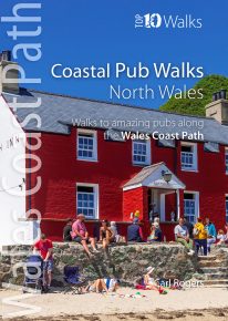
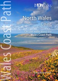
North Wales' best coastal pub walks
The comfortable, friendly and often upmarket pubs along the North Wales coast complement the walking on this superb stretch of the Wales Coast Path. Each walk incorporates a section of the Wales Coast Path, and starts and finishes close to a great, carefully selected pub. Combined, they cover the very best stretches of North Wales' coastline, one of striking contrasts and wonderful surprises. The easy, circular pub walks take in the North Wales Coast between Chester and Caernarfon, the Isle of Anglesey, and the remote Llyn peninsula. All the pubs are situated either right on the coast or a short hop inland — some in coves and harbours, some in the dunes or close to clifftops, others almost on the sand — and the majority are open all day. With the pubs often open all year and the walking good in all seasons, the North Wales Coast, Anglesey and the Llyn are quite rightly a year-round destination. -
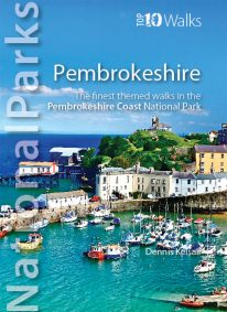
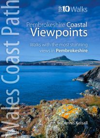 by Dennis Kelsall This attractive and good looking book will take you on ten short circular walks to some of the finest and most iconic views and viewpoints along the rugged Pembrokeshire coast, in West Wales. For some hillwalkers, the ‘view’ is only achieved on attaining the summit. But here, the endless convolutions of the coastline create an ever changing scene, both in front and behind; with every step shifting the perspective, bringing something different into sight. While the distant view can stretch for miles, inlets, coves and bays may remain hidden, only revealing themselves at the last moment. More immediately, the cliffs are broken by crevices, ledges, caves and natural arches, while just offshore are stacks and wave-washed shoals. Behind, the hinterland is a patchwork of hill, common and agriculture, while the vista out to the sea is endlessly changed by the weather, tide and hour. And, where accessible, the prospect from the beach is different again. Memorable walks to unmissable views.
 -
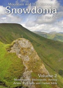 Mountain and Hill Walking in Snowdonia is a two volume in-depth guide to every summit of note in the Snowdonia National Park. Each recommended route is described in detail and accompanied by a full colour relief map. All the routes are circular and include information on parking, distance and height gained. Volume 2 covers the southern half of the National Park.
 -
 This new and wholly revised edition of a classic walking book contains fascinating, easy to follow walks exploring the unexpected past — from quiet strolls to hill and country rambles, by river, wood and ancient lane. A fascinating journey back in time ...
 -
 Discover the very best of the dramatic Snowdonia National Park, in North Wales. These ten themed walks will take you to the best and most iconic places across Snowdonia, from the mighty Aber Falls in the north, to Cadair Idris, in the south. Famous for its lofty mountains and open hills, Snowdonia is characterised, too, by dramatic upland lakes and tarns enfolded within glacial troughs and valleys, and short, steep rivers tumbling to the sea. Discover vast empty beaches, friendly pubs and stunning views, hidden lakes and awesome waterfalls, challenging hills and mighty mountains. Every one is a walk to enjoy and savour on the day, and to remember long afterwards.
 -
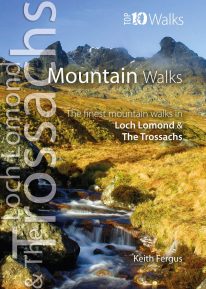 WITH MORE THAN FORTY MOUNTAINS over 2,500 feet spread across the Loch Lomond and The Trossachs National Park, it is tricky to choose just ten favourites. This careful selection aims to illustrate the rich diversity of mountain walks within the National Park. Classic Munros such as Ben Lomond and Stob Binnein are all visited, while other peaks are combined with near neighbours to provide more challenging walks. Enjoy the ten best circular walks exploring the mountains and beinns of the lovely Loch Lomond and The Trossachs National Park. Featured walks include:
- Ben Lomond (Ptarmigan Ridge),
- Ben Donich,
- The Cobbler,
- Ben Vorlich,
- An Caisteal,
- Cruach Ardrain,
- Beinn Odhar,
- Stob Binnein,
- Ben Venue
- Ben Ledi
-
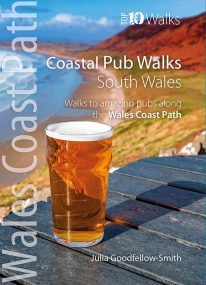
South Wales' best coastal pub walks
This pocket-sized guide gives walkers ten easy, circular walks to amazing coastal pubs along the South Wales section of the Wales Coast Path. With clear information, an overview and introduction for each walk, expertly written numbered directions, large scale Ordnance Survey maps, superb eye-grabbing panoramic photographs, and interpretation of points of interest along the way, these guides set a new standard in clarity and ease-of-use. Each of the short circular walks has been selected for both the quality of the pub and the walk itself. The routes cover the very best walking country in the area. All are in landscapes with particular historical or wildlife interest, and all follow part of the Wales Coast Path. -
Coming Soon

Scotland: Ben Nevis - Neck Gaiter/Scarf/Snood
Wearable large-scale 1:50,000 Ordnance Survey map artwork: Ben Nevis in Scotland
BEN NEVIS IS THE HIGHEST MOUNTAIN IN SCOTLAND AND THE BRITISH ISLES. Rising to 1,345 metres (4,413 ft) above sea level, the summit is reached by around 100,000 visitors a year. This detailed Ordnance Survey mapping snood shows the mountain and its awe-inspiring surroundings, making it the ideal present or souvenir for everyone who loves this most famous of Scotland's mountains. Note: While the Ordnance Survey mapping used on the snood is up-to-date at the time of production, it is not recommended for navigation. Walkers should carry the correct OS online or sheet map and compass.Ordnance Survey Licence No.: 0100047867
-
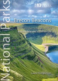 by Laura Hodgkinson This good looking, modern walking book will take you on ten short circular themed walks across South Wales' ever-popular Brecon Beacons National Park. The Brecon Beacons was Britain’s 10th National Park, established in 1957 to preserve and highlight the unique landscape of the area. The Brecon Beacons are said to be named after the historical practice of lighting beacons of fire upon hilltops to forewarn neighbouring valleys of invasion. The Brecon Beacons cover 1,344 square kilometres / 519 square miles with it’s spectacular waterfalls, valleys and expanse of hilly terrain; the Black Mountain to the west, the Fforest Fawr Geopark, Waterfall Country and the Pen y Fan range at the centre, and The Black Mountains to the east. The variety of flora and fauna is as vast as the landscape. Rare sub-arctic, alpine plants thrive within this unique climate. Mammals you're likely to spot include include wild mountain ponies, horseshoe bats, otters and water voles. Often seen birds of prey include the buzzard and iconic red kite. It's a wonderful area for walking and for everyone with a love of the outdoors.
 -
Coming Soon
Helvellyn - Neck Gaiter/Scarf/Snood
Wearable large-scale historic map artwork: Helvellyn in the Lake District
HELVELLYN HAS BEEN A POPULAR CUMBRIAN SUMMIT FOR MANY YEARS. The snood's tightly woven material features a detailed historic colour map dating from 1912 — and shows the mountain in all its timeless beauty. A wonderful keepsake, gift or souvenir Note: The historic mapping used on this snood is not recommended for navigation. Walkers should carry the correct modern OS online or sheet map and compass. -
 by Dennis Kelsall This superbly-written and good looking book will take you on ten short circular walks to the very best stretches of coast, pubs, tea shops, and viewpoints that the beautiful Pembrokeshire coast, in West Wales, has to offer. Defining the south-westernmost tip of Wales, Pembrokeshire’s coastline is arguably the most beautiful and varied in the British Isles. Virtually all of it lies within the Pembrokeshire Coast National Park. Relative isolation has left it largely untouched by modern development and most of its length is a wild frontier where the endless confrontation between sea and land is played out. Long stretches of coast face the fury of Atlantic storms and weakness and faults in the high cliffs are eroded into caves, coves and inlets. However, the harder rock, some of which is 700 million years old, resists the onslaught and stands out in rugged promontories and headlands. Elsewhere, sheltered landings and harbours, fine beaches and secluded bays reveal other aspects of this glorious landscape. In spring and summer the cliff tops break out in the pink, blue, white and yellow of countless flowers and sea crags are alive with nesting birds, while some of Britain’s largest seal populations arrive in autumn to give birth. It was this wild beauty that prompted the establishment of the Pembrokeshire Coast National Park in 1952. Despite being one of the UK’s smaller National Parks, it embraces a third of the county including all the offshore islands, the Daugleddau estuary, and the Preseli Hills. The Park is also home to the popular Pembrokeshire Coast Path — now part of the larger Wales Coast Path. Discover dramatic coastlines at St Davids Head and Strumble Head, Manorbier and Tenby. Climb to lofty coastal panoramas at Carn Ingli and Carn Llidi. Enjoy characterful waterside pubs at Porthgain and Cresswell Quay. Or relax over a quiet cup of coffee or tea and cake at two of Pembrokeshire’s cosiest and most welcoming tea shops and cafés. Unmissable.
 -
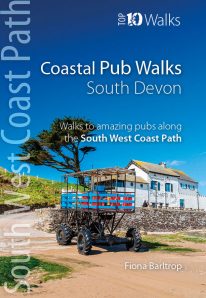
South Devon's best coastal pub walks
The lovely pubs along the South Devon coast complement the walking on this superlative stretch of the South West Coast Path. Each walk incorporates a stretch of the South West Coast Path, and starts and finishes close to a great pub. Combined, they cover the very best stretches of South Devon's coastline, one of great natural beauty and variety. The pub walks are ordered from west to east, starting at Noss Mayo on the Yealm estuary and finishing at Branscombe, near Beer. All the pubs are situated either right on the coast or a short distance inland — some in coves and harbours, others almost on the sand — and the majority are open all day. With the pubs open all year and the walking good in all seasons, the South Devon Coast is quite rightly a year-round destination. -
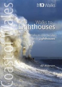 The ten walks featured here highlight the very best Welsh lighthouses and huge variety of the coastline of Wales. From vast expanses of sand, sea and sky, such as at Whiteford Point and Llanddwyn Island, to rugged coastline where seabirds wheel and skrike and porpoise and seals slide through the waves, like Strumble Head and South Stack, these walks to lighthouses guarantee a fine day out. All are circular, and vary from short and easy, like the to Talacre lighthouse, to longer and more demanding, such as that to St. Ann’s Head lighthouse — but none are beyond any reasonably fit and enthusiastic walker.