-
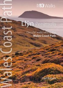 This handy little guide book gives you the ten very best short circular walks along the Llŷn peninsula section of the Wales Coast Path The Llŷn pushes 30 miles into the Irish Sea, tipped by the holy isle of Bardsey, or Ynys Enlli — ‘the island of 20,000 saints’. This remote and unspoilt landscape is characterised by traditional farms and compact villages, punctuated by volcanic hills. Its relative isolation has made it a haven for the Welsh language and culture. Sea cliffs, offshore rocks and intimate coves dominate the northern coast, while the gentler southern coast promises sandy beaches and holiday towns like Abersoch and Pwllheli. But for sheer beauty, tranquillity and wildlife, the Llŷn is hard to beat.
 -
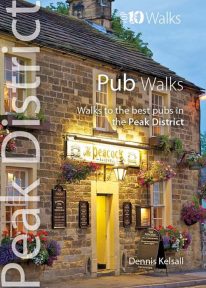 This handy pocket size book will take you on short circular walks to the ten best pubs in the Peak District. Ever since rambling became a recognised pastime, country pubs have been magnets for walkers. Whether a lunch-time stop along the way or a final destination for the day, the promise of a thirst-quenching pint or a hearty meal are, for many, an integral part of the day. Many of Peakland’s inns have their origins in serving the jaggers and stockmen who travelled the lonely upland routes. Today, they serve not only the locals but also the growing influx of recreational visitors. Long live the Peak District pub.
 -
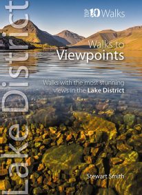 When it comes to hill walking, walks with views are much more fun than those without. These walks will also take keen photographers to come of the best places in Cumbria for taking those stunning images. Viewpoints are the walkers reward: the potential grandeur of the vista or panorama from just over the next incline or the atop the next crag is the incentive that draws on weary legs to summits. With lakes, rivers, forests, woodland, rolling countryside and craggy fells all crammed into such a compact geographical area, it’s no surprise that the Lake District is full of such stunning visual rewards, with unique and beautiful views around every corner.
 -
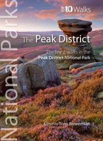
 Even the Peak District's name conceals a mystery. Forget the obvious: a visitor expecting towering peaks will be disappointed, as the name comes from the Pecsaetan tribe who once lived here. But there’s a twist: the Anglo-Saxon means “settlers of the Pec”…and that word pec has the same root as our peak, the dialect pike and the Pyrenean pic. So, ultimately, the Peak District is named after its peaks, after all. The Peak District is broadly defined by the conurbations at its corners: Manchester, Sheffield, Derby and Stoke. Within this rectangle, the National Park forms a rough oval of around 550 square miles. The area is traditionally divided into the Dark Peak – peat moorland edged by gritstone, with rugged villages in the valleys — and the softer White Peak - upland pastures defined by drystone walls, divided by gorges and limestone villages. The eastern and western moors are similar to the Dark Peak, but have their own subtly distinctive characters. The Peak District was occupied by humans long before the Pecsaetans and in each era man has left his mark, from prehistoric standing stones and rock art, through the folk legends, crosses and churches of the Middle Ages, to post-medieval follies and puzzling relics of the extraction of lime and lead. The varied geology of the area throws up natural curiosities too: its dark gritstone has wind-sculpted tors and edges, while its gleaming limestone hides caves and subterranean rivers. This handy pocket size book will take you on short circular walks to the ten most fascinating, odd or strange places in the Peak District. Prepare to be amazed and surprised.
 -
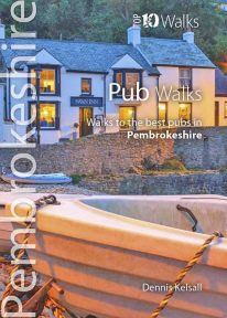 This attractive and good looking book will take you on ten short circular walks to some of the finest and most iconic pubs and inns in Pembrokeshire, in South Wales. Ever since rambling became a recognised pastime, country pubs have been magnets for walkers. Whether a lunchtime stop along the way or a final destination for the day, the promise of a thirst-quenching pint, bar snack or a hearty meal is for many, an integral part of the day. Many of Pembrokeshire's coastal inns have origins in serving seafarers, while those inland lay beside routes to and from the coast or beside old droves along which livestock were herded to market. Today, all have a fine tradition of serving visitors who come for no other purpose than to enjoy the magnificent countryside. Those chosen here have long established reputations for their food or ale and have an individual quirkiness worth seeking out.
 -
Coming Soon
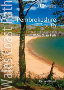 This lovely little book explores the ten best short circular walks along the southern part of the Pembrokeshire coast — itself part of the Wales Coast Path. The Pembrokeshire coast alters subtly from north to south. The southern rocks are far younger and the coast tends to be south-facing, too, creating a gentler hinterland. This influenced historical development and culture, for although the Norman advance extended throughout Pembrokeshire, settlement focused on the more fertile southern corner. It became known as ‘Little England’, with English rather than Welsh spoken, a tradition reflected in place names. Before reliable roads, trade and prosperity favoured the coast, and because the railways came late here, Pembrokeshire was largely ignored by the Industrial Revolution. Unspoiled and breathtakingly scenic, the coast is captivating every step of the way.
 -
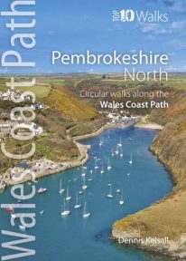 This photogenic book will take you on ten short circular walks along the northern part of the Pembrokeshire section of the Wales Coast Path. Pembrokeshire’s north coast has a rugged and remote quality, reflecting the wildness of the hills that rise behind. It was largely ignored during the Norman colonisation and even today beyond St Dogmael’s there are only a handful of coastal communities. Yet burial cairns, promontory forts and a pre-historic trackway across the Preseli Hills indicate widespread prehistoric settlement, and it was an important focus during the spread of Celtic Christianity. Fishing, farming and stock grazing were traditional ways of life, but the Industrial Revolution briefly opened coastal quarrying and the railway made Fishguard an important Irish port. Today, it is a relative backwater but the coast has an untamed beauty, its flowers, birds, seals and porpoises making it a truly special place.
 -
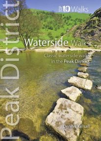 This pocket size book explores the ten best short circular waterside walks in the Peak District. Some follow lovely stretches of rivers; others explore the northern reservoirs. Several major rivers originate in the Peak, fed by countless springs, brooks and streams that have cut deep cloughs and gorges through the grit and limestone. Many powered the early industrialisation of the area while the valleys often served as conduits for trans-Pennine trade. Other dales, too steep or narrow for settlement or farming, or whose streams found subterranean courses, were ignored and today provide valuable wildlife habitats. And although the region has no significant natural lakes, reservoirs abound and are now largely naturalised within the landscape.
 -
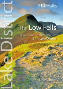 This superb pocket size book will take you on ten short circular walks to the ten best-known low fells in the Lake District The fells get their name from the Old Norse word, fjalls, which originally meant areas of rough upland grazing. Today, the Lakeland fells promise some of the best high level walking in England, and a real sense of freedom. But though the high fells often feature rocky summits, narrow edges and sheer cliffs, the lower fells, below the 2,000 foot contour, are greener, rounder and kinder. Walking on them can still be steep and strenuous, of course, but the routes are more suitable for the general walker. And the views are just as incredible.
 -
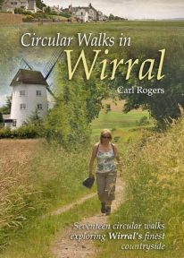 Circular Walks in Wirral will take you to some of Wirral’s most peaceful and scenic corners, and outlines 17 walks exploring Wirral's finest countryside spread throughout the peninsula.
 -
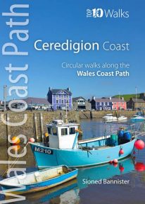 This handy pocket size book will take you on ten of the best short circular walks along the Ceredigion coast. Cardigan Bay embraces the dramatic sweep of the Welsh coastline, from Bardsey Island on the tip of the Llŷn in the north, to Strumble Head in Pembrokeshire in the south. It takes in parts of two National Parks: Snowdonia and Pembrokeshire, and three different counties: Gwynedd, Ceredigion and Pembrokeshire. The southern half of Cardigan Bay covers the rugged coastline between Aberystwyth and Cardigan. The dramatic cliffs and hidden coves are part of the Ceredigion Coast Path: a 60 mile trail that promises stunning views and some of the best opportunities for walkers to spot maritime wildlife in Wales.
 -
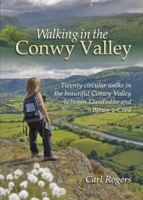 Twenty circular walks between Llandudno and Betws-y-Coed, in and around the beautiful Conwy Valley in eastern Snowdonia.
 -
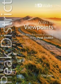 This handy pocket size book will take you on short circular walks to the ten finest views and viewpoints in the Peak District. Views are why many of us venture into the hills and countryside in the first place. Nothing beats a sweeping view from a moorland edge or hill, or an arching panorama over a pleasant valley. Sometimes it’s just the simple pleasure of the patterns of light and shade, the textures and colours of the woodland or the flowing beauty of the stream we’re walking beside. But typically there’s a feeling that you’ve earned a great view through sheer effort – even if the easiest approach had been taken to reach it. Perhaps that’s why so many of the great Peak District views are atop minor summits, at moorland edges, or overlooking deep valleys.
 -
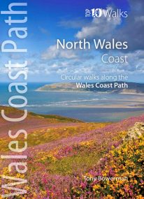
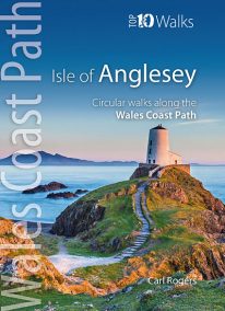 Product Description One of nine books in the new Top 10 Walks: Wales Coast Path series. The Isle of Anglesey offers some of the finest coastal walking in North Wales. In just over 125 miles there are dramatic sea cliffs, quiet coves, wide sandy bays, tiny fishing villages, modern resorts, coastal hills and remains from a rich maritime heritage. The walks in this book are what I consider to be the finest routes along this superb section of coast, one of the seven main sections of the wales Coast Path.
 -
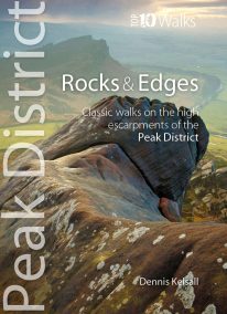 This attractive pocket size book will take you on short circular walks to the ten finest rocks and edges in the Peak District. Surprisingly for newcomers, the Peak District is almost devoid of anything resembling a traditional mountain peak (the name instead derives from the Old English paec, merely meaning ‘hill’). In reality, The Peak is a high, sloping plateau, cleft by deep valleys and winding ravines. In compensation, however, there are long runs of startlingly dramatic cliffs — here known as edges — and spectacularly weathered outcrops of rock, often referred to as tors. For rock climbers, they offer some of England’s finest challenges, while for walkers the views from the escarpments’ rims can be unforgettable.
 -
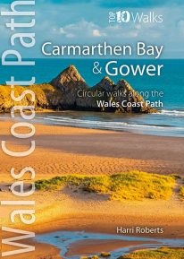 This handy, pocket size book will take you on the ten best short circular walks along the Carmarthen Bay and Gower stretch of the Wales Coast Path. Carmarthen Bay embraces an area of Welsh coast stretching from south Pembrokeshire to the Gower Peninsula. Long, sandy beaches and wide, silty estuaries dominate much of the bay, though there are also high cliffs and rocky coves in places. The Gower Peninsula, at the eastern end of the bay, is a small but priceless gem. Britain’s first official Area of Outstanding Natural Beauty (AONB), the peninsula contains an astonishing variety of landscapes: dunes, marshland, high cliffs, windswept downs, wooded valleys, picturesque villages and glorious sandy beaches — all linked by a superb footpath network.
 -
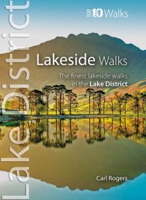 This popular pocket size book will take you on ten short circular walks to the finest lakeside paths in the Lake District. Lakeland’s characteristic lakes and meres are a legacy of the last Ice Age when vast ice sheets scoured out deep U-shaped valleys and upland combes. Today, sixteen main lakes and scores of smaller tarns punctuate the National Park. They include England’s longest lake (Windermere: 10½ miles long), and its deepest lake (Wast Water: 243 feet deep). Only Windermere, Derwent Water, Coniston Water and Ullswater have regular steamer and ferry services, yet every lake features dramatic waterside walks that will stay in your memory forever.
 -
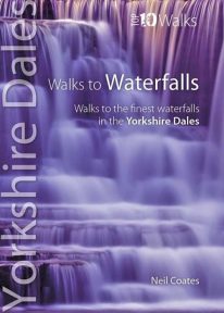 This pretty little book gives you short circular walks to the most spectacular waterfalls in the Yorkshire Dales. Geology and the way it shapes the land have created a countryside tailor-made for the development of waterfalls. The gritstone fells and moors gather copious rainfall, which they shed along countless becks and rivers that erode the rock into twisting gills and valleys. Where localised geological conditions bring together the grits and limestones, differential erosion creates bands of resistant rocks over which the becks plunge as hidden cataracts and waterfalls, often called forces in the Yorkshire Dales. Each has its own unique form and atmosphere to discover and explore.
 -
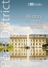 This lovely pocket size book explores ten of the Peak District's most fascinating historic landscapes — from prehistoric monuments to Industrial Revolution ruins. Stone tools from Thor’s Cave indicate that man arrived in the Peak as the glaciers receded. More obvious are Bronze and Iron Age circles, burials and earthworks, as well as the scars of mineral extraction — begun by the Romans and continuing today. Some Peakland churches claim Saxon foundation, and by the Middle Ages there was an extensive network of tracks and settlements. Water powered the first industrial revolution, bringing roads, canals and railways, and in the fine country mansions, farmsteads, cottages and town houses there is a rich variety of vernacular and classic architecture.
 -
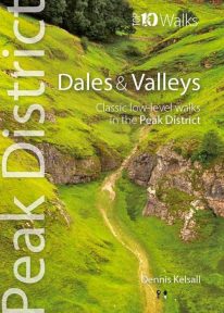 This attractive pocket size book gives you the ten very best dale and valley walks in the Peak District. The White Peak is known for dramatic limestone gorges: convoluted pathways carved into its heart, where rearing pinnacles, dark caves and thundering rivers struck awe into seventeenth-century travellers. Still captivating today, they harbour rich woodland, wildflower meadows and disappearing and resurgent streams, one of the area’s strangest curiosities. Delightful Dovedale, once the haunt of the renowned anglers Izaak Walton and Charles Cotton, contrasts with Cave Dale, a gaunt, dry passage below Castleton’s Norman stronghold. But the Dark Peak has attractive valleys too, and different again is the Dane Valley, which cuts onto the Cheshire Plain from the gritstone moors.
 -
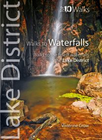 WINNER OF THE OUTDOOR WRITERS AND PHOTOGRAPHERS’ GUILD’S ‘BEST GUIDEBOOK’ AWARD 2013 This attractive pocket size book features ten easy, short circular walks to the most amazing Lake District waterfalls. The dramatic waterfalls of the Lake District are mostly a by-product of the last Ice Age — the awesome result of the ancient interplay of ice and rock. Given perpetual life by the region’s high rainfall, they come thundering down from the fells in a variety of forms. No two are the same. Many carry the name ‘force’—from the old Norse foss simply meaning ‘waterfall’—a remnant of the times when Norsemen dominated these uplands. Unmissable!
 -
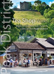 The Peak District abounds with cafes and tea shops offering fabulous, freshly brewed coffee and a mouthwatering variety of speciality teas. This pocket-size guide picks carefully selected cafés across the Peak District — in locations ranging from former stations to community cafés, National Trust properties to hillside farms, and bakeries on town streets to tearooms tucked down alleyways. All of them offer a great choice of often home-baked or locally sourced produce, and a pleasant place to relax after a refreshing walk. This handy pocket size book will take you on short circular walks to the ten friendliest and most fantastic cafes and tea shops in the Peak District.
 -
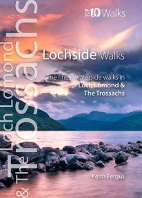 The ten best circular walks exploring the area’s seawater and freshwater lochs and lochans, including lochs Lomond, Katrine, and Venachar. Stunning scenery and unusual wildlife. Featured walks include: Luss, Balloch Castle Country Park, Loch Lomond NNR, Balmaha & Milarrochy, Sallochy Wood & Dun Maoil, Along Loch Katrine, Loch Ard, Loch Katrine & Loch Arklet, Inversnaid & Loch Lomond and Loch Venachar.
 -
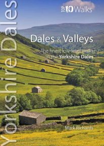 This lovely pocket size book describes the ten best short circular walks in the Yorkshire Dales' dales and valleys. The focus in the Yorkshire Dales tends to be on a trio of much-loved valleys: Swaledale, Wensleydale and Wharfedale. Yet, broadening the gaze, one finds other equally spellbinding valleys, such as Airedale, Ribblesdale, the Rawthey and Dentdale. To the north, the bounding valleys of the Eden and Lune stretch the beauty of the National Park into wider horizons of pastoral serenity. Here are walks for quiet enjoyment and seasonal beauty, where nature still reigns amid traditional patterns of farming practice. Solid stone barns and field walls characterise the dale bottoms; and the flora of the dales is wonderfully diverse: many a meadow retains its native herbal mix — yielding a delightful aroma at haytime.
 -
 This lovely little book contains the ten best short circular walks along the north part of the Cardigan Bay section of the Wales Coast Path Cardigan Bay embraces the dramatic sweep of the Welsh coastline, from Bardsey island on the tip of Lleyn, in the north, to Strumble Head in Pembrokeshire, in the south. It takes in parts of two National Parks: Snowdonia and Pembrokeshire, and three different counties, Gwynedd, Ceredigion and Pembrokeshire. The striking northern section between Porthmadog and Borth is as varied as it is beautiful. Characterised by vast beaches and rugged cliffs, the coast offers superb walking with ever-changing views and a wealth of wildlife.
 -
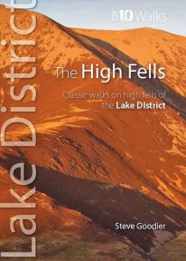 This handy, pocket size book explores ten short circular routes on the best high fells in the Lake District. The Lakeland fells have inspired writers, artists and walkers for centuries. Like the deep valleys that separate them, they were formed by the flow and grind of ancient ice sheets. Above the 2,000-foot contour, they form a high mountain environment whose sheer cliffs, narrow edges, and exposed rocky summits demand respect. Today, this rugged upland landscape is one of the most visited hill walking areas in Britain. The high fells feature enough classic routes, challenges and captivating views to delight even the most demanding fell walker.
 -
Dorset's best coastal pub walks
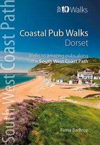
The excellent pubs along the Dorset coast complement the walking on this superlative stretch of the South West Coast Path. Each walk incorporates a stretch of the South West Coast Path, and starts and finishes close to a superb pub. Combined they cover the very best stretches of Dorset’s coastline, one of great natural beauty and variety. The pub walks here are also ordered from west to east, starting with Lyme Regis and finishing at Studland. All the pubs are situated either right on the coast or a short distance inland — some in coves and harbours, others right on the beach — and almost every one is open all day. With the pubs open all year and the walking good in all seasons, Dorset’s iconic Jurassic Coast is a year-round destination. -
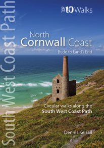
Bude to Land's End
The ten walking routes featured here highlight the best short circular walks along the North Cornwall Coast section of the popular, 630-mile long South West Coast Path (SWCP). From Bude to the western-most tip of England at Land's End, Cornwall's northern coast has a character all its own. Much of its 140 miles is set against the open Atlantic, whose winter storms and thundering waves have sculpted a rugged coastline of formidable cliffs. Tiny, wave-washed coves and zawns contrast expansive beaches and dunes, the wild scenery often spilling offshore to half submerged reefs, stacks and rocky islands. The holiday resorts of St Ives and Newquay can attract summer crowds, but elsewhere, the coast is often deserted, with only birds for company and the delights of nature as distractions. The five-book series of 'Top Ten Walks' covers the whole of the UK's famous South West Coast Path. Each book explores the highlights along the way; showcasing its natural beauty, wildlife and heritage. Once you've tasted what the North Cornwall section has to offer, we think you'll be inspired to come back to tackle the complete trail. -
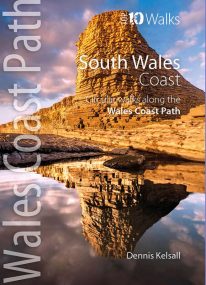 Product Description One of nine books in the new Top 10 Walks: Wales Coast Path series. The past two centuries have wrought more change on South Wales than any other section of the country’s coast. Until the end of the 18th century, Swansea, Barry and even Cardiff were just small ports, though their ships traded far and wide. The industry of iron and coal changed things forever but most of the coast and its immediate hinterland were left unspoiled and elsewhere, nature has reclaimed some of what was taken. The coast is one of extreme contrasts, ranging from great dune systems through sheer cliffs to miles of coastal saltmarsh. Nowhere is far from a delightful stretch overlooking the sea, with fine views, nature and heritage all around.
 -
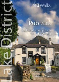 Here in one pocket size book are ten, easy, short circular walks to the finest Lake District pubs. The words ‘Lakeland’ and ‘pub’ go together like ‘bread’ and ‘butter’ or ‘Romeo’ and ‘Juliet’. The Lake District is a region that’s famed for its traditional inns and cosy, friendly village pubs almost as much as it’s famed for its magnificent walking country. So, what could be better than combining the two—enjoying a pint of local ale half-way through a gorgeous Sunday stroll, or a hearty meal at the end of a day’s hiking?
 -
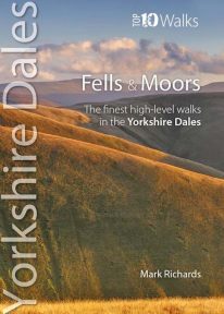 This attractive pocket size book features the ten finest short circular walks on the fells and moors of the Yorkshire Dales. The term ‘fell’ derives from the Norse settlers and was applied here to areas of upland pasture. While the Lake District is defined by its soaring ridges, the Dales, as their name implies, are an intricate pattern of valleys set in a muted moorland landscape. Yet great hills exist — to enthral and enthuse even the most ardent hillgoer. There is no better way of grasping the scale, beauty and extent of the Yorkshire Dales than from this fabulous compact of high fell tops. Each rooted in a dale, each dignified with unique prospects, all meriting walking as a richly rewarding company of hills.
 -
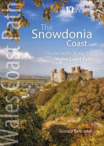
 Product Description One of nine books in the new Top 10 Walks: Wales Coast Path series. This attractive and cleverly structured guidebook gives walkers the ten best walks on the southern part of the South Wales Coast section of the Wales Coast Path, in a popular pocketable format. With clear information, an overview and introduction for each walk, expertly written numbered directions, Ordnance Survey maps, superb, eye-grabbing panoramic photographs, and interpretation of points of interest along the way, these guides set a new standard in clarity, appeal and ease-of-use. Contents The Wales Coast Path: an introduction Top Ten Walks: Wales Coast Path: North Wales Coast: a photo mosaic
- Holywell & Basinwerk Abbey
- Talacre & Gronant dunes
- Prestatyn to Graig Fawr
- Rhyl to Rhuddlan Castle
- Little Orme
- Around the Great Orme
- Conwy Mountain
- Above Penmaenmawr
- Aber Falls
- Lafan Sands - low/high loop
-
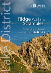 The Lakeland Fells have some of the finest ridge walks in the country. Exploring these ridges offers fell walking at its most satisfying — staying high, taking in several summits and enjoying the spectacular settings. Many of the Lake District’s ridge walks have become classics, like the grassy edges of the Fairfield and Kentmere Horseshoes, or rocky aretes of Striding Edge and Swirral Edge and the aptly named Sharp Edge of Blencathra.
 -
 Discover the very best of the Peak District. These ten themed walks explore the contrasting faces of the Peaks — the gentle White and rugged Dark Peak. Discover clear rivers and streams, ancient packhorse bridges and stepping stones. Walk through winding dales and valleys bright with wildflowers. Visit stately Chatsworth or marvel at the panorama from Monsal Head. Tour upland reservoirs and dramatic rocky edges popular with climbers. Slog up Shutlingsloe or explore the open moorland and strangely eroded tors on Kinder Edge. Every one is a walk to remember.
 -
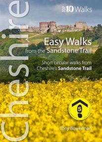 Cheshire’s Sandstone Trail is probably the most popular middle-distance walk in Northwest England. The Trail runs for 55 kilometres/34 miles along Cheshire’s beautiful and varied central sandstone ridge between Frodsham and Whitchurch, just over the border in Shropshire. This cleverly structured and well designed guidebook gives walkers the ten best short circular walks along the length of the Sandstone Trail in a handy, pocketable format.
 -
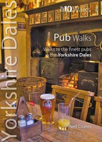 This lovely little book will take you on short circular walks to some of the Yorkshire Dales' most distinctive pubs and inns. The pubs of the Yorkshire Dales reflect both the area and the local people: occasionally gritty and challenging, sometimes uncompromising but essentially hugely welcoming and full of character. Some of England’s best watering holes stand here beside country lanes and village greens as they have for centuries past, gathering and exuding that unique amalgam which defines a pub. The flagged floors, the winter fires, the lamplight pooling onto lanes through bottle-glass windows, the quirky bars; that happy jigsaw of time and place which makes rambling to and between them one of life’s great pleasures.